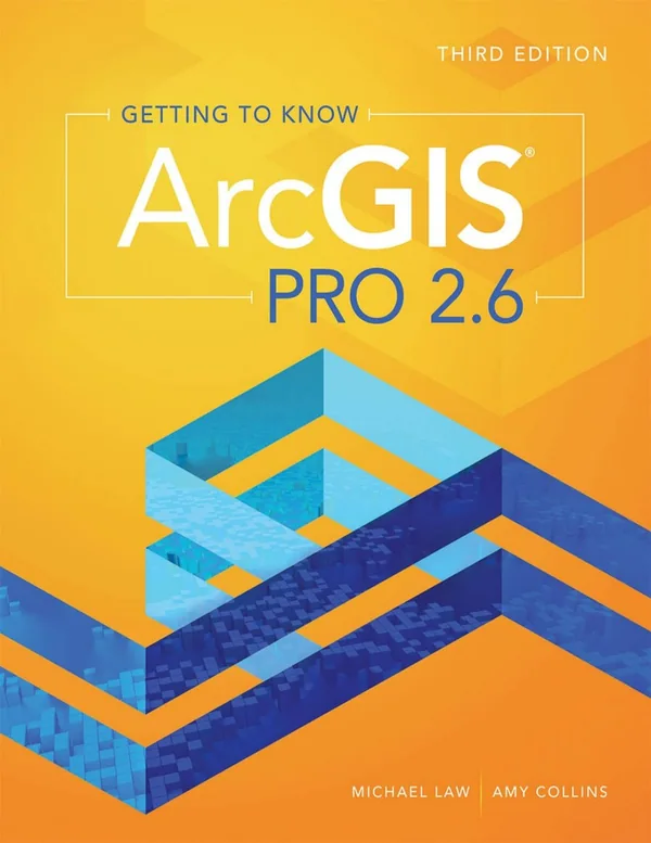
Getting to Know ArcGIS Pro, third edition, introduces desktop GIS through progressive tutorials and practical mapping tasks. Michael Law and Amy Collins guide beginning GIS students and professionals through projects, geodatabases, data editing, spatial analysis, map layouts, and sharing, connecting the ArcGIS Pro interface with workflows used to organize and interpret geographic information.
Inside this title
Progressive tutorials introduce projects, maps, layouts, and geodatabase organization
Current listed price $12.00Regular price $21.00Digital ebook
Projects and the ribbon interface establish the starting point for learning ArcGIS Pro. Illustrated instructions then guide study of spatial data creation, editing, and management, including feature classes, tables, and geodatabase organization. Each stage builds toward a more connected understanding of a GIS project.
Mapping topics include symbology, labels, and page layouts, while analysis introduces overlay, proximity, and surface tools. Publishing web maps and layers extends the workflow to sharing geographic results. The third edition is designed for tutorial-based introductory GIS learning and professional reference, particularly for readers who want to connect individual software tools with the broader process of building, analyzing, and presenting spatial data.
Study guide included
Inside Getting to Know ArcGIS Pro, 3rd Edition.
Law and Collins treat ArcGIS Pro as a place to do accountable geographic work, not just a set of buttons. Each project begins with a place and a question, then moves through layers, tables, editing, and analysis. The book keeps data ownership, record matching, and map design in view at every step.
The third edition follows a deliberate progression. The first chapters present GIS, desktop projects, and how a map relates to its source records. Later exercises join Illinois health data to income and grocery information, construct a utility geodatabase for a water system, and design a tree inventory shared with volunteers. Geocoding, incident analysis over time, a vineyard suitability model, and the broadband mapping exercise round out the sequence. ArcGIS Pro 2.6 is the software context throughout, so tool names and interface details belong to the 2020 edition rather than to current releases.
Maps Pair Geometry With Attribute Records
Geographic information systems keep two kinds of information together: where something sits and what is recorded about it. Opening a public map means reading its layers, checking the owning account, and saving a separate working copy before changing anything. The Contents pane governs display while the Catalog manages resources, and a project can still lean on data stored elsewhere.
Inspect layer records before trusting symbols
Save a separate working copy first
Note which datasets accompany a project
Chs. 1–2 · Introducing GIS and A First Look at ArcGIS Pro
Joining Tables Rewards Careful Key Checks
An attribute join links rows by a common identifier, while a spatial join moves or summarizes values according to geography, for instance a tract inside a county. Both demand scrutiny before results are used. Repeated keys, unmatched rows, and features straddling a boundary all change what the output means. The Illinois obesity and grocery access exercise shows how a tidy map can hide those problems.
Test identifiers for repeats and gaps
Count matched output against input rows
Decide a rule for boundary features
Ch. 3 · Exploring Geospatial Relationships
Editing Depends on Structure and Meaning
A geodatabase keeps feature classes alongside tables under one organized structure. The water network exercise divides feature types by purpose and gives each attribute a definite meaning plus a suitable type. Templates supply defaults, and snapping helps a new line meet an existing junction. Even a technically valid snap can attach a pipe to the wrong neighbor, so geometry and attributes deserve separate review.
Define what each feature represents before editing
Verify endpoints against the junction you intended
Review attributes apart from geometry
Ch. 4 · Creating and Editing Spatial Data
Repeatable Steps Make Shared Collection Trustworthy
Tasks, ModelBuilder, script tools, and Python commands offer different degrees of automation, and the right choice turns on how much discretion stays with the operator. The tree inventory project extends the same logic to volunteers in the field. Fields must be settled before collection begins, permissions must match the task, and a small pilot reveals whether participants can produce consistent records.
Match automation level to the judgment required
Settle field definitions before volunteers start
Run a pilot and compare two records
Chs. 5–6 · Facilitating Workflows and Collaborative Mapping
Location Error and Time Bins Matter
Geocoding turns address text into estimated positions using a reference locator, and the estimate is only as good as the input. The housing access exercise shows how missing street names or wrong postal details leave records unmapped, which can make a neighborhood look underserved. The robbery project then separates a density surface from a statistical test for clustering, because binning dates changes what appears.
Review unmatched and ambiguous address records
Distinguish a density surface from a clustering test
Explain how dates and units were binned
Chs. 7–8 · Geoenabling Your Project and Analyzing Spatial and Temporal Patterns
Suitability Scores Narrow the Field
The vineyard model derives terrain measures from elevation — slope, aspect, and a hillshade surface — then scores and weights them when screening candidate sites. Any ranking reflects the thresholds and weights chosen, so repeating the model with different priorities reveals whether a site stays strong. The broadband exercise then turns a filtered result into a layout, where the legend, title, scale bar, and permissions must all serve the audience.
Test whether a candidate survives reweighting
Report close alternatives instead of one winner
Let the decision shape layout and legend
Chs. 9–10 · Determining Suitability and Presenting Your Project
Chapter and section map
A First Look at ArcGIS ProCh. 2, p. 29
Exploring Geospatial RelationshipsCh. 3, p. 69
Creating and Editing Spatial DataCh. 4, p. 113
Facilitating WorkflowsCh. 5, p. 157
Collaborative MappingCh. 6, p. 197
Analyzing Spatial and Temporal PatternsCh. 8, p. 271
Determining SuitabilityCh. 9, p. 313
Presenting Your ProjectCh. 10, p. 347
Key takeaways
Check identifiers and unmatched rows before letting a joined map support a comparison across places.
Record inputs, settings, and edit ownership so a colleague can rerun the work and question it.
Test alternative weights and show uncertainty before a suitability ranking guides a decision.
Beginning GIS students and working professionals who want a structured, exercise-driven path into ArcGIS Pro 2.6, especially readers who learn best by completing projects rather than reading reference entries.
Topics covered
ArcGIS Pro tutorials
spatial data editing
geodatabase design
spatial joins
geocoding accuracy
suitability modeling
map layout design
temporal crime analysis
Other editions of this title.
Compare editions, prices, and book details before you choose.
Edition, audience, and study-guide details at a glance.
What is Getting to Know ArcGIS Pro, 3rd Edition about?
Getting to Know ArcGIS Pro, third edition, introduces desktop GIS through progressive tutorials and practical mapping tasks. Michael Law and Amy Collins guide beginning GIS students and professionals through projects, geodatabases, data editing, spatial analysis, map layouts, and sharing, connecting the ArcGIS Pro interface with workflows used to organize and interpret geographic information.
Which edition of Getting to Know ArcGIS Pro, 3rd Edition is this?
This listing is for the 3rd edition. Check the title, ISBN, and book details above before ordering, especially if your course or reading list names a specific edition.
Who is Getting to Know ArcGIS Pro, 3rd Edition for?
Beginning GIS students and working professionals who want a structured, exercise-driven path into ArcGIS Pro 2.6, especially readers who learn best by completing projects rather than reading reference entries.
Does this page include a study guide?
Yes. This page includes an original study guide with six thematic sections, key takeaways, and a chapter and section map for structured reading.